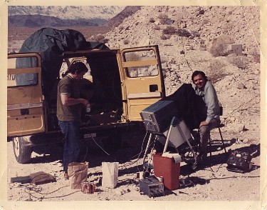
Developing the first ground-penetrating radar! 1973 at a Dolomite Mine near Lone Pine, California, with Bob Bollen. Preparing for our first radar study of the pyramids of Egypt.
by Lambert Dolphin
formerly Senior Research Physicist
SRI International, Menlo Park, California
Geophysical methods can be very useful in exploring for oil, minerals, or for locating buried objects. Most methods in use today were developed five or six decades ago and have not been improved upon greatly since their inception. Each method has its strengths---and often severe limitations that are imposed by nature. The advantage of geophysical survey techniques is that they do not disturb the site, can usually be performed quickly, and they are very cost effective compared to excavation costs. When they can be used these methods can be very helpful in evaluating the site geologically and for delineating areas of interest and eliminating barren ground. Among the more recent tools developed for probing beneath the surface of the earth is ground-penetrating radar.
GPR's utilize a very short burst of radio-frequency energy radiated into the ground to detect discontinuities in the ground. These discontinuities can be cavities, voids, transitions between soil and rock, filled areas, or buried objects. The performance of these radars is limited by attenuation of the signals in moist soils, especially soils having high clay content. The volcanic soils and rocks of the Philippines were thought to be moderately favorable for GPR. This has been confirmed by my own three field trips to the Philippines in search of Japanese World War II treasure booty. GPR's are similar to normal atmospheric and space radars in that an echo is reflected back to the observer from a remote target. Rather than bouncing a signal from an aircraft of space vehicle, GPR's look for a boundary between rock and air (a cave or cavity) or between one type of soil and another (for example undisturbed soil-to back-filled soil). The strength of the echo is dependent on the absorption of the signal to and from the radar to the target, the size and shape of the target, and the degree of discontinuity at the reflecting boundary.
Developing the first ground-penetrating radar! 1973 at
a Dolomite Mine near Lone Pine, California, with Bob Bollen. Preparing for
our first radar study of the pyramids of Egypt.
Ground penetrating radars (GPRs) have some unusual characteristics. The transmitted pulse is very short-which allows for accurate measurement of distances from the antennas on the surface to the sub-surface targets. However antennas having narrow beams can not in practice be built for such radars. Thus it is often difficult to localize the target in terms of direction. One can only say that the target most probably lies somewhere on the surface of the segment of a sphere of radius r, whose cone angle is 120 degrees. Likewise individual radar echoes seen at the radar receiver display can not be easily processed-they must be manually scaled and interpreted. GPR data analysis still remains as much of an art as a science 20 years after these radars were first developed. When a radar signal is introduced into the earth unwanted reflections (known as "clutter") usually appear on the radar display in addition to echoes from the sub-surface targets one is looking for. Separating out these clutter echoes is also a factor in successful interpretation of the data requiring operator skill and experience.
Because the radar signals from GPR's are well-coupled into the ground there is seldom and trouble with spurious radar reflections from targets above the surface of the ground. A more serious problem limiting the usefulness of GPR's at many locations in the world is the attenuation of the radar signals in the sub-surface medium. To minimize these losses a low radar frequency is desired. However low frequencies mean long wavelengths so that the radar's ability to localize and resolve targets is reduced. Frequencies between 30 MHz and 150 MHz are commonly used. This band corresponds approximately with the lower portion of the standard VHF television band.
Absorption of radar signals in the earth is dependent on a soil or rock's moisture content, and especially the salt content of that moisture. Clay soils have by nature very high radar losses because of their molecular ionic structure. In wet clay soils it is often impossible for a GPR to penetrate deeper than a few feet no matter how much transmitter power is available. In dry or otherwise favorable rock types 100 to 300 feet of penetration is often possible. Volcanic soils (characteristic of the Philippines) are variable in their conductivity but often reasonably favorable for radar propagation. Soil and rock electrical conductivity (or resistivity) is the characteristic parameter most affecting the rate radio waves are absorbed as a function of distance in soils and rocks. The GPR I used in my recent surveys of several World War II treasure sites in the Philippine Islands is a custom built unit built by Advanced Microwave Technology Inc., of Los Altos, California. The transmitted pulse generated by this GPR consists of a single RF cycle burst of energy at the desired frequency. Peak power radiated is 30 kilowatts. This power level is a factor of 30 times greater than the peak power available from commercially available GPR's. A portable 150 MHz- bandwidth Tectronix 485 or 585 radio-frequency oscilloscope is used to display the received signal. The transmitting and receiving antennas consist of resistively loaded wire antennas. Three configurations of GPR's are in use today. A portable surface radar allowing point by point measurements was the unit used for the survey described in this report. GPR's can also be cart mounted for shallow surveys over large flat areas. The third version of the GPR is a borehole radar which allows viewing through the side-walls of 4" boreholes. The boreholes can be up to 400 feet deep.
revised April 3, 1995, November 7, 1997.
Related articles:
Uses and Limits of GPR
GPR and Unexploded Ordinance
Geophysical Methods in Archaeology
Geophysical Methods and the Temple Mount
Geophysical Exploration in Israel: The 1983 Field Season
Scientific Treasure Finding
Links to Related Internet Sites:
Geovision Geophysical Services
Geophysical Survey Systems (GSS)
Lambert Dolphin
lambert@ldolphin.org
Library
I am now retired from Geophysical Work. Contact International Radar Consulnatnts, Inc. for expert geophysical help.